
About Lunedale
Lunedale Parish is situated within Teesdale in the south of County Durham.
The population reside on isolated farms, or in small farming hamlets, mainly in the east of the parish. The B6276, from Teesdale west to Brough in Cumbria passes through the southern part of the parish, which is unusual locally in being diamond shaped, rather than a narrow east-west strip.
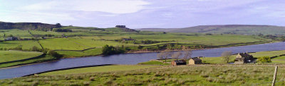
Covering 90 square km, the land rises towards the west, until the impressive heights of Cronkley and Mickle Fells are reached in the north and west respectively.
Teesdale in County Durham has the lowest population per square mile of any other district in England. Over 50% of the dale lies within the North Pennine Area of Outstanding Natural Beauty. Teesdale has outstanding natural and man-made features several of which, such as High Force (the highest waterfall in England), Raby Castle (home of the Lords Barnard since 1626) and the impressive Bowes Museum (which has the finest collection of European fine and decorative art in the North East of England) are major tourist attractions.
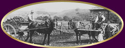
The area has a rich history of lead mining and farming and is served by the historic market town of Barnard Castle and the smaller, former lead-mining market town of Middleton-in-Teesdale.
Lunedale, which prior to 1974 was the most northwesterly part of the North Riding of Yorkshire, is a very sparsely populated area of Upper Teesdale with barely 40 homesteads. Its unique flora, fauna and geology give the area national and international importance.
